Northern Circuit Mount Kilimanjaro
“The Newest and Longest Kilimanjaro Route”
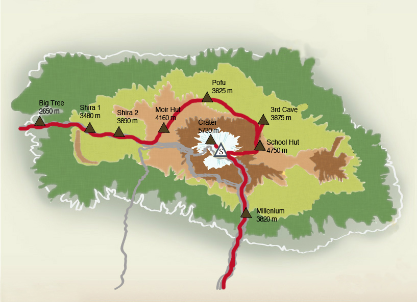
The Northern Circuit mount Kilimanjaro is the newest and longest route on Mount Kilimanjaro, this route begins in the West at the Londorossi Gate and follows the same path as the Lemosho Route for the first 2 days. After crossing the Shira Plateau the path veers north near Lava Tower, following the longer Northern Circuit instead of the Southern Circuit which is more popular via Barranco Valley.
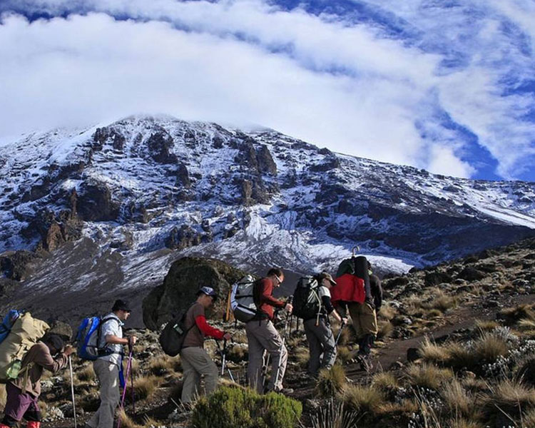
This route circles around the quieter northern slopes to the east side of the mountain from this point, however all approach the summit via Gilman’s Point and then either descend via the Mewke Route joining trekkers from the Machame, Umbwe, Lemosho and Shira’s Routes or via the Marangu Route.
Northern Circuit Route Map
The Northern Circuit is longer than the other trails in Kilimanjaro taking a minimum of 8 days to complete, though 9 day trek is also offered. The additional time on the mountain means that success rates for Northern Circuit trekkers are relatively high.
The 8 day Trek skips the additional acclimatization day that is usually spent at Shira Camp 2 and continues straight on to Moir Camp via Lava Tower.
Itinerary For Kilimanjaro Northern Circuit
This Kilimanjaro Northern Circuit is for a 9 day Northern Circuit trek using the Mweke Route for descent.
Day 1 – Londorossi Gate (2,100 meters) – start point 2,360 meters to Mti Mkubwa Camp (2,820 meters)
Distance: ~5.5km / 3.5 miles
Trekking time: 3-4 hours
Zone: Rainforest
This route begins at Londoross Gate (2,100 meters) in the West, the same start point as the Lemosho Route.
On the day of the hike, you will be picked from your hotel in either Moshi or Arusha and head to the Gate which is a drive of approximately 2 hours, you will register with the park authorities at the gate and then be driven further up the mountain to the trailhead starting point.
In most cases, you will have lunch before the short first trek to Mti Mkubwa Camp (2,820 meters) begins. During the hike you get lucky and spot large wildlife like elephant, cape buffaloes that sometimes emerge from the rainforest onto the path as you trek towards your first camp.
You will have dinner at Mti Mkubwa Camp.
Day 2 – Mti Mkubwa Camp (2,820 meters) to Shira Camp 1 (3,610 meters)
Distance: ~8km / 5 miles
Trekking time: 5-6 hours
Zone: Low-alpine zone
On Day 2, you will spend the first hour trekking through the last section of rainforest path before entering the low alpine moorland zone which follows up onto the Shira Plateau. The trek is relatively short and gradual and ends at Shira Camp 1 (3,610 meters).
Day 3 – Shira Camp 1 (3,610 meters) to Shira Camp 2 (3,850 meters)
Distance: 7km / 4 miles
Trekking time: 3-4 hours
Zone: Low-alpine zone / High-alpine zone
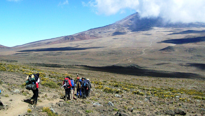
On Day 3, the trek acrosses the Shira Plateau from Shira Camp 1 to Shira Camp 2. 9 day trekkers usually spend the night at Shira Camp 2 where they will join trekkers. 9 day trekkers usually spend the night at Shira Camp 2 where they will join trekkers from the Machame Route.
At Shira Camp 2, it is worth trekking a little higher up to the plateau to enjoy the stunning views across the valley below and Western Breach of Kilimanjaro above.
The plateau is exposed so be prepared for a cold night with temperatures normally getting below zero.
Note: Trekkers on an 8 day Hike will continue east uo the Shira Plateau ridge and on to Lava Tower (4,600 meters) and then back down via the Northern Circuit to Moir Camp (4,200 meters).
Day 4 – Shira Camp 2 (3,850 meters) to Lava Tower (4,600 meters) and then north to Moir Camp (4,200 meters)
Distance: 14 km / 8 miles
Trekking time: 5-7 hours
Zone: High-alpine zone
Day 4 is a long trek heading East which passes through the Garden of Senecios and then enters the alpine desert zone, the morning is spent trekking up to Lava Tower and the iconic Shark’s Tooth rock formation at 4,600 meters, you will have lunch at this point.
After lunch you will join the northern circuit heading down to Moir Camp at 4,200 meters, this is an important day in your trek as you will get to experience high altitude and then sleep low which is good for the acclimatization process.
Day 5 – Moir Camp (4,200 meters) to Buffalo Camp (4,020 meters)
Distance: 12 km / 7.5 miles
Trekking time: 5-7 hours
Zone: High-alpine zone
Day 5 of the hike involves a moderately steep climb out of Moir Vally, trekkers can take a small detour here to climb the summut of Little Lent Hill at 4,375 meters before returning to the Northern Circuit trail.from here the route follows a series of inclines and declines, skirting around the northern slopes of Kibo to Buffalo Camp (4,020 meters).
The trek provides great vistas out across the plains that lie north of Kilimanjaro and stretch out to the Kenyan/Tanzanian border, you will arrive at Buffalo Camp just after midday where you will have lunch and have time to rest after a long day hiking.
Day 6 – Buffalo Camp (4,020 meters) to Rongai Third Cave (3,800 meters)
Distance: 8 km / 5 miles
Trekking time: 5-7 hours
Zone: High alpine zone and low alpine zone
Day 6 starts with a climb up the Buffalo ridge and down into Porfu Camp where lunch is usually served, the route then continues east around the northern slopes to the Rongai Third Cave at 3,800 meters.
The trek is generally shorter than the day before and by now you should be feeling well aclimatised to the altitude, you will arrive at the Third Cave just around mid-afternoon.
Day 7 – 3rd Cave (3,800 meters) to School Hut (4,800 meters)
Distance: ~15km / 8.5 miles
Trekking time: 4-5 hours
Zone: High alpine zone
Day 7 of the hike involves a steady incline up and over the Saddle which sits between the peaks of Kibo and Mawenzi Peak, trekkers then continue walking south – west up to School Hit (4,800 meters).
After arriving at School Hut, you will have an early dinner and then get some sleep, you will be awoken before midnight to start your summit attempt.
Remember to prepare all your gear including warm clothes, insulated water bottles, snacks, headlamp and camera before going to bed
Day 8 – School Hut (4,800 meters) to Uhuru Peak (5,895 meters) and then onto Millennium Camp (3,950 meters)
Distance: ~6km / 3.5 miles ascent and 10.5km / 6 mile descent
Trekking time: 6-8 hours ascent and then 4-6 hour descent
Zone: Glacial zone and all preceding zones
You will be awoken around 11:30 with hot tea and biscuits and will then begin the steep incline up the slopes of Kibo under the cover of darkness, your first check-point is Hans Meyer Cave where you will take a short break.
The climb steepens as you approach Gilman’s Point (5,681 meters) which will be around 5-6 hours after departing School Hut.
You will have a moment to enjoy the approaching dawn and incredible view out and across to Mawenzi Peak, but remember you still have 2 hours trekking to reach Uhuru Peak so dig deep for the energy. The slope flattens as you head west around the crater rim and you should arrive at the summit at or just after sunrise. Your stay here will be brief so get as many pictures as you can of the incredible views and surrounding glaciers.
You will then retrace your steps back around the crater rim to Stella Point (5,739 meters), where you will turn south and head down the heavily screed slopes of Kibo to Barafu Camp (4,680 meters).
Most trekkers prefer taking a short break here before continuing down to Millennium Camp (3,950 meters) for the final night on the Mountain, in total you will be trekking for 14-16 hours on day 8 so it is important to pace yourself. Remain hydrated and keep your blood sugar levels up.
Note: some trekkers return via Gilman’s Point to Horombo Hut using the Marangu Route.
Day 9 – Millennium Camp (3,950 meters) to Mweka Gate (1,640 meters)
Distance: ~10km / 6.5 miles
Trekking time: 3-4 hours
Zone: Rainforest zone
Day 9 is the final day of the hike, it is a short hike through the dense montane rainforest from Millennium camp (3,950 meters) to Mweka Gate (1,640 meters).
At the gate you will need to sign-out with the authorities who will also provide you with your official certificate, trekkers who made it to Gilman’s Point will be rewarded with a green certificate and those who reached Uhuru Peak will be rewarded with a gold certificate.
It is a custom to give your guides and porter tips after the experience, you will then be driven back to your hotel in Moshi or Arusha.
Northern Circuit Kilimanjaro Route Altitude Profile
Here’s what the Kilimanjaro Northern Circuit route altitude profile looks like.
