Machame Route
The Most Popular and Well Profiled Kilimanjaro Route
The Machame Route is one of if not the most popular route on Mount Kilimajaro, the route is loved by most trekkers because it provides impressive views and a variety of habitats and is also one of the cheaper routes on Mount Kilimanjaro due to its easy access and shorter itinerary. According to statistics from the Kilimanjaro National park Authorities, 50% of the trekkers use the Machame Route to ascend Mount Kilimanjaro. Also this route is chosen by most seasoned climbers
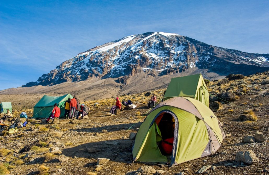
Machame Route is also known as the Whiskey Route, it gained its reputation for being a tough route to climb in contrast to easier Marangu Route which is known as the Coca Cola Route.
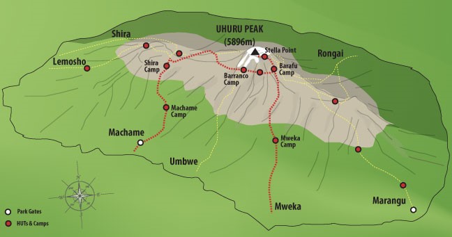
Machame Route Map
Machame Route is a relatively difficult route as climbers need to be able to ascend the Barranco Wall on day 4 and contend with a steep incline up Kibo on summit night. The route has no parts that require any technical climbing skills, the total distance of Machame Route is approximately 62 kilometers from the gate to the gate.
One can complete the Machame route on a 6 or 7 day trek/ itinerary, both options include a climb high, sleep low in acclimatization day.
Itinerary of Machame Route – 7 Days
Day 1 – Machame Gate (1,640 meters) to Machame Camp (2,835 meters)
Distance: ~11km / 7 miles
Trekking time: 5-7 hours
Zone: Rainforest
Day 1 trek begins at Machame Gate (1,640 meters), you will be picked from Moshi or Arusha to the gate which takes approximately a hour from Moshi and 2 hours from the Arusha.
Along the way you will enjoy sights of substance farming and the Machame Town.
At the Gate you will meet your trekking crew include the guide, porters and cook, there will be a flurry of activity as porters assemble gear for the trek, weighing packs to ensure they don’t exceed 20 kilograms.
Trekkers together with the guides and climbing team will begin the ascent through the stunning rainforest that covers the Sout – West of the Mountain, first day trek on the Machame Route is a long one (11 kilometers/ 7 miles) and takes approximately 5-7 hours to complete.
Packed lunch and 2-3 liters of bottled water will be provided during the trek.
The day’s trek ends at Machame Camp (2,835 meters) which is near the border of the rainforest zone and the low alpine zone, by the time you arrive your porters will have already setup your camp and tents, dinner will be served.
Day 2 – Machame Camp (2,835 meters) to Shira Camp 2 (3,850 meters)
Distance: ~5km / 3 miles
Trekking time: 4-6 hours
Zone: Low-alpine zone
Day 2, you will rise early pack your gears and prepare for the trek from Machame Camp to Shira Camp 2(3,850 meters). The trek is relatively steep as you enter the low alpine Zone which is characterized by moorlands and grasslands. Shira Camp 2 sits on a plateau which provides you with the first views of Kibo in the North-West and Mount Meru in the East. Day 2, takes approximately 4-6 hours and covers a distance of 5 kilometers/3 miles.
Day 3 – Shira Camp 2 (3,850 meters) to Lava Tower (4,600 meters) and then Barranco Camp (3,900 meters)
Distance: 11km / 7 miles
Trekking time: 5-7 hours
Zone: Low-alpine zone / High-alpine zone
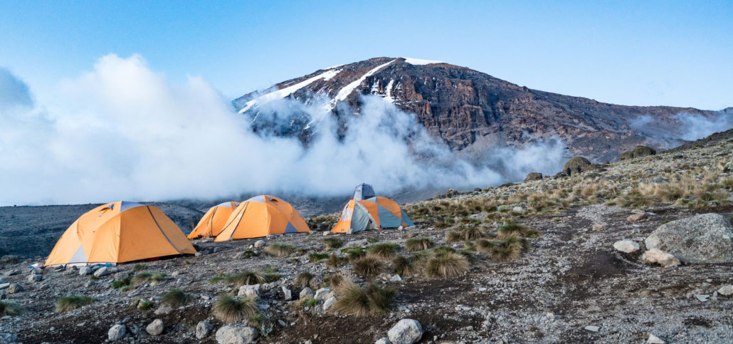
Day 3 is along and tough trek East off the Shira Plateau through the “Garden of the Senecios” up to Lava Tower and the Shark’s Tooth rock formation at 4,600 meters and then back down via the Southern Circuit to Burranco camp (3,900 meters).
The route is approximately 11 kilometers/ 7 miles in length and takes 5-7 hours to complete.
Although you end the day at a very similar elevation to when you started from Shira Camp, it is arguably one of the most important days on your trek as it gives you a chance to climb high and sleep low which is important for proper acclimatization.
Day 4 – Barranco Camp (3,900 meters) to Karanga Camp (3,960 meters)
Distance: 12 km / 7.5 miles
Trekking time: 6-7 hours
Zone: High-alpine zone
Day 4 – the trek on Machame Route begins with a steep traverse up the Barranco wall, a 257 meter rock face that requires basic scrambling skills to the top of the Karanga Valley. The path then follows a series of inclines and declines to Karanga Camp (3,960 meters).
Trekkers on the 7 – day route spend the night at Karanga Camp before continuing on to Barafu on day 5, this additional day is beneficial in terms of acclimatization.
If you are on a 6- day trek, you will stop for lunch at Karanga Camp and then continue on along the Southern Circuit until it joins the Mweka Trail up to Barafu Camo (4,680 meters). For 6-day trekkers, day 4 takes approximately 8-10 hours to complete and covers 9.5 kilometers.
When you arrive at Barafu around mid-afternoon you will be served an early dinner and you are encouraged to get some rest as the summit trek commences around 24:00 that night.
Day 5 – Karanga Camp (3,960 meters) to Barafu Camp (4,680m)
Distance: 6 km / 4 miles
Trekking time: 3 hours
Zone: High-alpine zone
Day 5 is a short and easy day, the trail starts at Karanga Camp and joins the Mweka trail up to base camp – Baraful at 4,680 meters.
It is recommended you use the easy hiking to relax and prepare for the summit push.
Day 6 – Barafu Camp (4,680 meters) to Uhuru Peak (5,895 meters) and then Mweka Camp (3,100 meters)
Distance: ~4.5km / 3 miles ascent and then 11km / 7 mile descent
Trekking time: 6-8 hours to the summit and then 5-8 hours to Mweka
Zone: Glacial zone and the all preceding zones
Day 6 is summit night and day, you will be woken around 23:30 with hot ttea and biscuits. Hopefully you have managed to get a few hours’ sleep, don’t worry if you haven’t as most people struggle to sleep before summit night.
However make sure that all your kits including warm clothes, headlamp, insulated water reserves and snacks are ready for a sharp departures at 24:00.
The trek up Kibo is steep and slow, the trick is to keep your momentum moving forward, one step at a time. It takes about 6-8 hours to reach the top of the crater rim where you will see the sign for Stella Point (5,739 meters).
Stella Point is not the summit of Kilimanjaro, you still have another 156 meters of altitude to walk around the crater rim to Uhuru Peak., we recommend resting briefly at Stella Point and potentially having some hot tea or hot chocolate. Dawn should be approaching, take a moment to savour where you have got to and then dig deep for the energy to push for the summit. Over 60% of the climbers stop at Stella Point but most can make it to the summit if they muster the mental strength to push through. Obviously if you are experiencing AMS Symptoms, you should descend immediately.
After reaching the summit of Kilimanjaro, a 4.5 kilometers/ 3 mile ascent, you still have an 11 kilometers / 7 miles descent to Mweka Camp (3m100 meters), the descent can be very grueling on your joint. It is recommended you use trekking poles and potentially wear gaiters to avoid fine glacial scree getting into your boots. Mweka is situated in the upper part of the rainforest zone, the richness of oxygen and moisture in the air will be a very welcome surprise.
Day 7 – Mweka Camp (3,100 meters) to Mweka Gate (1,640 meters)
Distance: ~9km / 5.5 miles
Trekking time: 3-5 hours
Zone: Rainforest
Day 7 is the final day of trekking on the Machame Route with the trek taking 3-4 hours, assuming you successfully reach Stella Point or Uhuru Peak you will be presented with official certificate – a green certificate for the Stella Point and a gold certificate for Uhuru Peak.
Route Altitude Profile for Kilimanjaro’s Machame
