Lemosho Route – Mount Kilimanjaro
“A Remote And Beautiful Route On Kilimanjaro”
The Lemosho Route is a relatively new and hiker’s favorite Kilimanjaro routes, the route is loved by hikers because of its ideal balance of low crowds, beautiful scenery and a high summit success rate.
The Lemosho Route is considered to be the most scenic trail on Kilimanjaro granting panoramic vistas on various sides of Mount Kilimanjaro, this route starts on the Western side of Mount Kilimanjaro at the Londorossi Gate. The route was introduced as an alternative route to the Shira Route which begins at a higher and more challenging altitude.
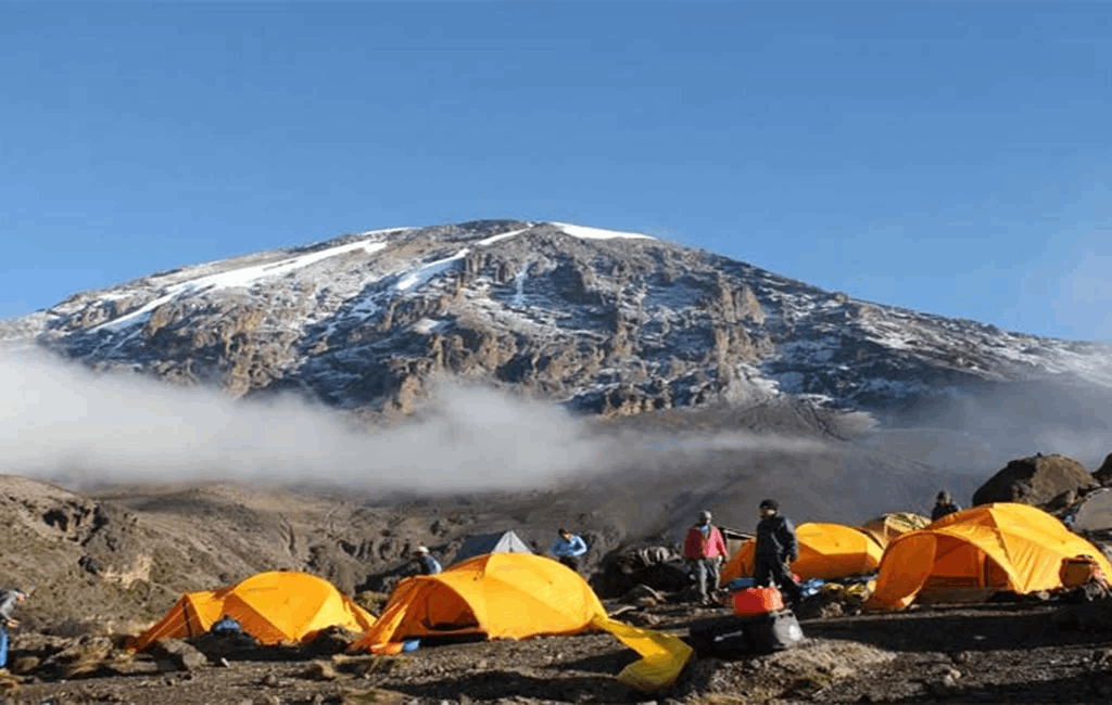
To reach the Londorossi Gate is a fair driver from the town of Moshi and considerably further from Arusha, at the gate you will register for the experience with the authorities before begin driven a further 12 kilometers to the starting point.
The western side of Kilimanjaro is still very wild and hikers may get lucky and spot large antelopes, buffalo and sometimes elephants.
The Lemosho Route joins the Machame Route at Lava Tower and heads down toward Burranco Valley via the Southern Circuit, as with the Machame Route, trekkers on Lemosho Route need to transverse the Barranco Wall and then summit from Barafu Camp. Dscent is via the Mweka Route.
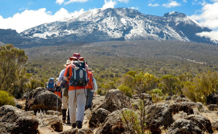
Map of Lemosho Route
Most trekkers on Lemosho Route complete the route in 8 days, however 7 days and 6 days hikes are offered though they are not recommended on the Lemosho route.
The 8-day variation is great for acclimatization and of course increases the probability of success, 7 day route typically stops for a night at both Shira Camp 1 and Shira Camp 2. 8 day trek stops again at Karanga Camp for another day for acclimatization.
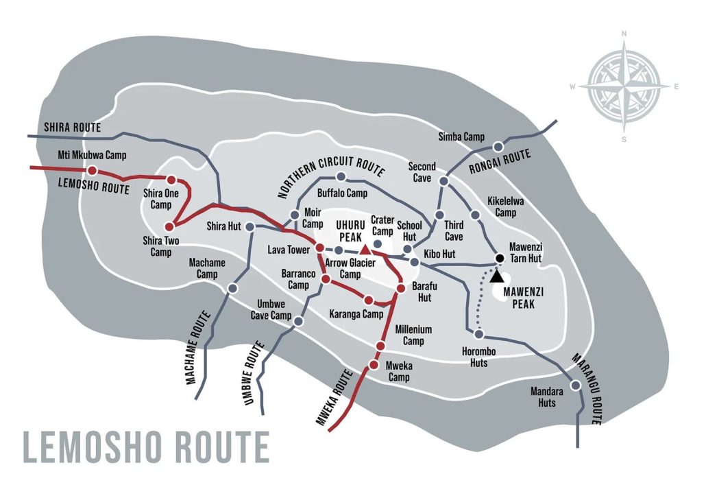
Detailed itinerary of Lemosho Route
Day 1 – Londorossi Gate (2,100 meters) – start point 2,360 meters to Mti Mkubwa Camp (2,820 meters)
Distance: ~5.5km / 3.5 miles
Trekking time: 3-4 hours
Zone: Rainforest
The Lemosho Route departs from the far West side of Mount Kilimanjaro, to get to the Londorossi Gate (2,100 meters) takes approximately 2 hours from Moshi and a bit longer from Arusha. At the gate you will register with the authorities of Kilimanjaro National Park then get back into vehicles to be transported to the starting point which is a further 12 kilometers from Londorossi.
During the wet seasons in April – May, the track can be very inaccessible to vehicle and you may need to walk the last few miles to the starting point. Most tour operators provide lunch at this point before starting the short trek to Mti Mkubwa Camp (2,820 meters).
Trekkers might be lucky to spot large wildlife like elephants and buffaloes, dinner will be served when you reach Mti Mkubwa Camp.
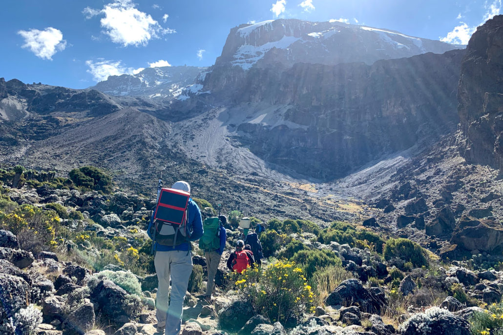
Day 2 – Mti Mkubwa Camp (2,820 meters) to Shira Camp 1 (3,500 meters)
Distance: ~8km / 5 miles
Trekking time: 5-6 hours
Zone: Low-alpine zone
Day 2 of the trek starts with a gradual hike through the final stretch of the rainforest zone and then gets steeper as you approach the low alpine moorland zone. The trek is relatively short and easy to Shira Camp 1 which is on the western edge of the Shira Plateau, just over 8 kilometers from the starting point.
Day 3 – Shira Camp 1 (3,500 meters) to Moir Hut (4,200m)
Distance: 14km / 8.5 miles
Trekking time: 5-7 hours
Zone: Low-alpine zone / High-alpine zone
Day 3 the hike continues from Shira Camp across and up the Shira Plateau to Shira Camp 2 at 3,850 meters, here you will join trekkers from the Machame Route whilst enjoying stunning views across the valley below and Western Breach of Kilimanjaro above.
The plateau is exposed so be prepared for strong winds with temperatures getting below zero in the early hours.
Day 3’s hike is long and finishes at high altitude, you may start feeling altitude sickness symptoms, make sure you monitor yourself closely. Sleeping high on this night will pay dividends on your trek going forward.
Day 4 – Moir Hut (4,200 meters) to Lava Tower (4,600 meters) and then Barranco Camp (3,900 meters)
Distance: 12 km / 7.5 miles
Trekking time: 6-7 hours
Zone: High-alpine zone
Day 4 – you will continue trekking through a desert-like landscape as you approach Lava Tower and the Shark’s Tooth formation at 4,600 meters, you will have lunch at Lava Tower before joining the Southern Circuit trail which descends to Barranco Camo 3,900 meters where you will spend the night at a very similar elevation as the night before.
Climbing high and sleeping low is a good way to acclimatize the body to altitude.
Day 5 – Barranco Camp (3,900 meters) to Karanga Camp (3,960m)
Distance: 7 km / 4 miles
Trekking time: 4 hours
Zone: High-alpine zone
On day 5 of the trek, you will be presented with the relatively steep Burranco “Breakfast” climb, a 257 meters crample up the Barranco Wall. Be prepared to use all the four limbs as you traverse the wall to the top of the Karanga Valley. From here you will follow a path that sojourns through many inclines and declines to Karanga Camp (3,960 meters). For those on an 8 day hike, this will be your camp where you will stay for the night.
7 Days trekkers will stop here for a brief lunch before continuing on through the barren desert landscape that leads to the Mweka trail and up to Barafu Camp (4,680 meters).
Day 6 – Karanga Camp (3,960m) to Barafu Camp (4,680m)
Distance: 6 km / 4 miles
Trekking time: 3 hours
Zone: High-alpine zone
Day 6 is a relatively short and easy trek starting at Karanga Camp on a trail that quickly joins the Mweka route and heads up to base camp, Barafu at 4,680m.
It is recommend you use this easy day to enjoy the scenery, rest the muscles and prepare you mind for the summit push.
Day 7 – Barafu Camp (4,680 meters) to Uhuru Peak (5,895 meters) and then Mweka Camp (3,100 meters)
Distance: ~4.5km / 3 miles ascent and then 11km / 7 mile descent
Trekking time: 6-8 hours to the summit and then 5-8 hours to Mweka
Zone: Glacial zone and the all preceding zones
Day 7 start at mid-night with a hot tea, biscuits and a long and zigzagging hike up the heavy scree that covers the steep slopes of Kibo, the going is slow and very tough. You will need to dig deep and ensure you maintain a consistent pace to push yourself up to the crater rim.
After about 4-6 hours of hiking, you will reach Stella Point (5,739 m) where you will have a chance to rest and watch the beautiful dawn break across the Tanzanian landscape. It is a good idea to have some hot tea or hot chocolate at this point as you will need to muster the energy to continue for another 1-2 hours around and up the crater rim to Uhuru Peak (5,895 meters).
Remember to keep your momentum moving forward, one step at a time. Over 60% of climber’s stop at Stella Point but most can make it to the summit of they are able to find the mental strength to push through. If you are experience severe AMS symptoms you should descend immediately.
You will spend a brief time at Uhuru Peak, take as many pictures as you can, savour your accomplishment and then start heading back to Stella Point. Many trekkers slide down the scree slopes of Kino to Barafu Camo where you will have a chance to rest before continuing on to Mweka Camp (3,100 meters). In total you will be trekking between 12-16 hours on day t so it is very important that you pace yourself and remain hydrated.
At this point you will be seeing the summit from a distance.
Sunrise, with the summit in the distance. Not far to go now!
Day 8 – Mweka Camp (3,100 meters) to Mweka Gate (1,640 meters)
Distance: ~9km / 5.5 miles
Trekking time: 3-5 hours
Zone: Rainforest
Day 8 is the final day on mountain Kilimanjaro and it is a short day trek but very tiring as your body will be exhausted and your knees will likely be sore from the previous day’s descent.
Go slowly and enjoy the wonderful rainforest scenery as you head towards Mweka Gate (1,640 meters). At the gate, you will be rewarded with certificates either for Stella Point or for Uhuru Peak, sign-out with the authorities, offer tips to your trekking team then depart back to Moshi or Arusha.
Altitude Profile Mount Kilimanjaro’s Lemosho Route
