Formation of Lake Albert
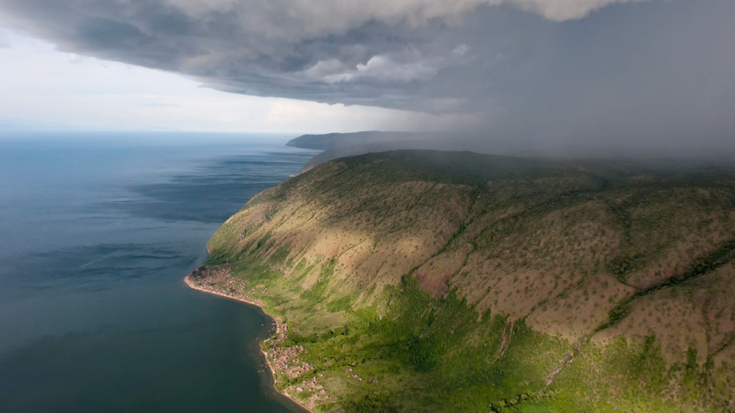
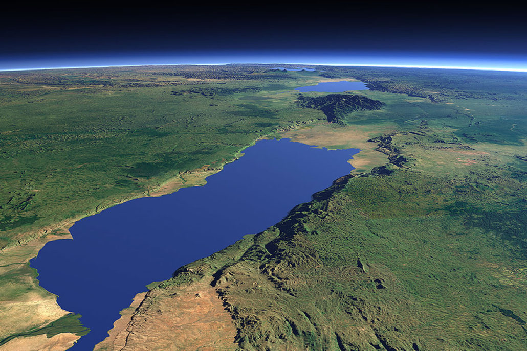
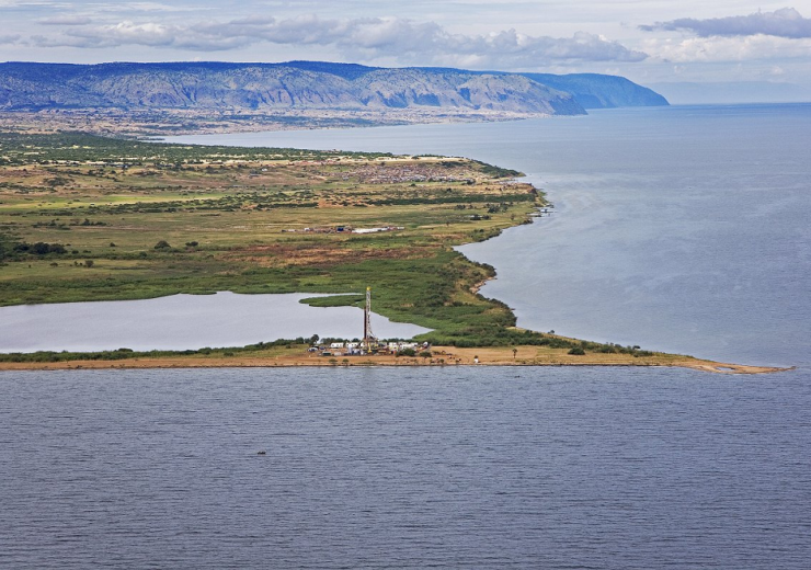
Formation of lake Albert : East African Lake Albert is a naturally occurring freshwater lake that is situated between Uganda and the Democratic Republic of the Congo (DRC). It is a component of the East African Rift System’s Albertine Rift, a geological feature.
Tectonic action and sedimentation are two of the geological and environmental variables that led to the development of Lake Albert.
Lake Albert’s Formation Tectonic Activity:
A significant geological fault system, the East African Rift System extends from Ethiopia’s Afar Triangle to Mozambique. The African Plate separated into the Somali Plate and the Nubian Plate, two smaller plates, which is what defines it.
Strong geological activity, such as faulting and volcanic eruptions, is linked to the rift system. The tectonic forces that have been tearing apart the Earth’s crust in this area for millions of years are responsible for the construction of Lake Albert, which is located within this rift system.
Understanding the relationship between rift valleys and tectonic activity is essential to understanding how different landforms on Earth emerge and change over time.

I’ll explain both terms in more detail now:
Tectonic Movements:
The movement and interactions of the lithospheric plates, which comprise the outer layer of the Earth, are referred to as tectonic activity.
Several huge and countless smaller plates make up the lithosphere, and they “float” on top of the semi-fluid asthenosphere. Numerous geological phenomena are the outcome of the continual motion of these plates.
Key elements of tectonic activity include the following:
Plate Boundaries: At these boundaries, where the plates can interact in a number of ways, tectonic activity is most noticeable.
Divergent limits: Plates separate from one another at divergent limits. Rifts or rift valleys are frequently formed as a result of this movement.
Convergent borders: Plates approach one another at convergent borders. This may result in the formation of mountains, deep ocean trenches, and subduction—the movement of one plate beneath another.
Transform Boundaries: Earthquakes along fault lines are caused by plates sliding past one another horizontally at transform boundaries.
Volcanism: When molten rock, or magma, from the Earth’s mantle rises to the surface, tectonic action can cause volcanoes to emerge. Along divergent and convergent plate borders, volcanoes can form.
Earthquakes: The shifting of plates and their interactions frequently result in tension along fault lines, which can abruptly unleash seismic energy.

Rift Valley: As the African Plate began to break, the East African Rift System formed a rift valley. This region’s weakening and thinning crust made it possible for the land to sink and form a depression, which eventually gave rise to Lake Albert.
A rift valley is a lowland area or linear depression on Earth’s surface that develops when tectonic forces cause a section of the Earth’s crust to be dragged and stretched apart. Divergent plate borders are commonly linked with rift valleys. The following are some essential traits of rift valleys:
Formation: Tensional tectonic forces cause rift valleys to emerge. These pressures cause the crust of the Earth to weaken and form depressions by tearing it apart. A rift valley may eventually occur as a result of the crust’s continued stretching and thinnedness.
Features: Faults, grabens, or down-dropped blocks, and horsts, or uplifted blocks, are some of the distinctive geological features typical of rift valleys. Rivers or lakes may be found on the sediment-filled rift floor.
As an illustration: A few well-known rift valleys are the Great Rift Valley in East Africa, which has many rift valleys and is renowned for its varied landscapes and geological features, and the East African Rift System, which is linked to the development of the East African Rift Valley.
Because they shed light on the processes of continental rifting and the early phases of plate boundary development, rift valleys are significant geological features.

If the crust stretches and thins more over millions of years, rift valleys may eventually transform into new ocean basins, resulting in the total separation of formerly related landmasses.
Sedimentation: As the rift valley formed throughout time, water from several sources started to fill the depression that the tectonic forces had created. Precipitation and rivers and streams that empty into the basin were major contributors to the depression’s water-filled state.
Variable Water Levels
Variable Water Levels: Throughout history, variations in the Semliki River, Lake Albert’s primary tributary, and variations in rainfall patterns have all contributed to variations in the lake’s water levels. Over time, these variations have affected the depth and extent of the lake.
Changes in Geology:
Geological Changes: The development and features of Lake Albert were also influenced by the regional geology, which includes the kinds of rocks and sediments.
One of the many lakes in East Africa created by the tectonic processes connected to the East African Rift System is Lake Albert. It is a component of an intricate ecosystem and geological system that is still changing across long geological epochs.
In conclusion, tectonic activity within the East African Rift System is the primary driving force behind the complex geological process that formed Lake Albert in East Africa. The following are the main causes of this lake’s formation:
Tectonic Movements:
The African Plate is dividing into the Somali Plate and Nubian Plate near Lake Albert, which is located inside the East African Rift System.
The Earth’s crust has weakened and subsided as a result of this tectonic action, leaving a depression that will eventually becom the lake.
Formation of the Rift Valley:
A rift valley formed in the area as a result of tectonic processes stretching and thinned the Earth’s crust, providing the first geological foundation for the formation of the lake.
Dissemination:
The Semliki River’s inflow as well as water from rivers, streams, precipitation, and other sources were all accumulated over time in the rift valley. Water progressively filled the depression as a result of this sedimentation process.
Variable Water Levels:
Changes in the temperature, rates of sedimentation, and the amount of water entering Lake Albert from its tributaries have all caused variations in the lake’s size and depth over time.
Geological Elements:
The features of the lake were shaped in part by the local geology, which included the kinds of rocks and sediments.
The creation of Lake Albert is evidence of the dynamic character of the geology of our planet and the continuous plate tectonics-related geological processes.
It is a crucial illustration of how tectonic forces may sculpt the topography and produce enormous bodies of water, which in turn affects the ecosystems and human groups that depend on them.


